Klapka Tallgrass Prairie
About this prairie
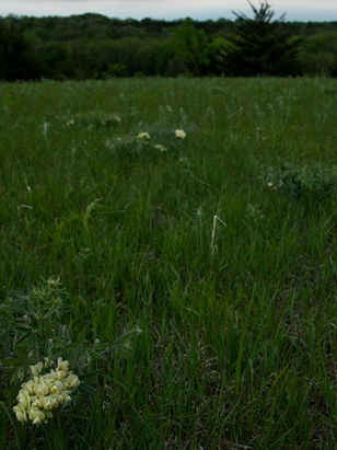
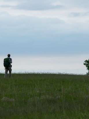
Klapka Farm is Wachiska Audubon's largest tract of prairie at just under 400 acres. Located southeast of Table Rock, it has three separate pieces of native Prairie totaling 30 acres, with the remaining 370 acres in native pasture, and reseeded native prairie hayland. Elmer Klapka left the land to WAS with the stipulation that the land be returned to natives and the Prairies to remain unplowed. Here you find glacial till soils with Sioux quartzite boulders and steep hills with limestone outcroppings. The far southeast 40 acres has 20 acres of our most scenic and diverse Prairie with limestone outcroppings and a view out over the Big Nemaha valley down into Kansas.
Researchers from UNL are interested in the Eastern gama grass. Nebraska Game and Parks has selected the grass for their pollinator inventory. The target species for Pawnee County are Bobwhite Quail and Massasauga rattlesnake. While we see quail quite regularly, the rattlesnake is more elusive, wintering in crayfish holes. The main requirement for the program is to manage grazing, leaving cover for wildlife.
Restoration/Management Work:
25 acres-excellent condition in 3 separate locations; 111 acres-fair/good condition in 3 separate locations; 32 acres-poor condition in 1 location; balance of property in various
stages of prairie restoration.
Prescribed fire is implemented on the prairie tracts to control smooth bromegrass and eastern red cedar trees. Mechanized tree removal equipment is used to cut and stack the broadleaf trees, then treat the stumps.
In the pastures we have installed a seven-cell grazing system with cross fencing, water pipelines and tanks with USDA cost share assistance. The pastures are currently enrolled in the USDA’s Grassland Conservation Reserve Program.
We have two tenants, one for the grazing land and one for the hayland. Arnold serves as the property and farm manager. He works with the haying schedule and develops a grazing plan with the tenants as well as the rental agreements. He scouts for invasive and noxious weeds, spot spraying small infestations like leafy spurge and works with contractors for larger problem areas infested with sericea lespedeza and/or musk thistles. We are constantly fighting the invasive trees like Siberian elm, locust, ash, hedge and Eastern red cedars. Arnold also checks and repairs fences, moves electric chargers around and makes sure the water is okay.
Last season with a volunteer crew we burned 100 acres of pasture, hayland including two small prairies. It was followed with tree shearing, stump treatment, and spot spraying for weeds and small trees. Our newest concern is old world or Caucasian bluestem. Next year we will be seeding the last piece of cropland to a mix of native grasses and pollinator friendly forbs.
Type of habitat:
Remnant Tallgrass Prairie
Location:
Pawnee County, southeast of Table Rock, Nebraska
Size (Acres):
400 Acres
Wildlife and Plant Species Found Here:
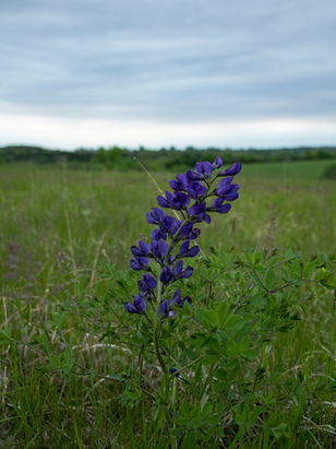
Flora: porcupine grass, Eastern gama grass, sideoats grama, prairie dropseed and big bluestem. Forbs include New Jersey tea, inland ceanothus, butterfly milkweed, coneflowers, and cat claw sensitive briar, cream wild indigo, blue-false indigo, compass plant, buffalobur, partridge pea, wild licorice, hoary puccoon, wild rose, prairie ironweed.
Fauna: regal fritillaries, great crested flycatcher, scissor-tailed flycatcher, yellow warbler, loggerhead shrike, orchard oriole, baltimore oriole, grasshopper sparrow, massassagua rattlesnake, bobwhite quail, lubber grasshopper, bell's vireo, brown thrasher, eastern kingbird, northern bobwhite, blue grosbeak, northern mockingbird, common yellowthroat, common nighthawk, red-headed woodpecker, indigo bunting, lark sparrow.
Map
Directions
GPS Coordinates:
Northeast Tract: 40°08'47.9"N 96°04'09.8"W
Southeast Tract: 40°08'41.1"N 96°04'11.1"W
Southwest Tract: 40°08'42.0"N 96°05'01.5"W
Google Maps Address:
Northeast Tract: 4WWJ+F58, Table Rock, NE 68420, USA
Southeast Tract: 4WVJ+V4R Table Rock, NE, USA
Southwest Tract: 4WV8+XGR Table Rock, NE, USA
At east edge Table Rock and intersection NE 04 and Pawnee Street, proceed east-southeast on Pawnee Street until intersecting with Ave 626 (~0.25 mile), proceed south ~ 2.25 miles on Ave 626 to the intersection with Rd 712; ~120 acres located immediately southeast of intersection, ~ 240 acres ~0.5
miles east on north side of Rd 712, and, ~40 acres 1 mile east on south side of Rd 712; Native prairies in excellent condition located in three separate locations on property (need a map for precise locations).
Links


